
Once our microlight had taken off we flew up to 2,250 feet. Having walked the entire Kent coastline, I was looking forward to seeing some of it from the sky. Almost immediately we flew over something I had not seen from the ground. It was the wreck of a German submarine from the First World War. All forms of identification have been removed so nobody actually knows which submarine it is, though it is generally believed to be either UB-122 or UB-123.

UB-122 was commissioned in March 1918 and then surrendered to the British in November of that year as part of the Armistice agreement. She is believed to have been broken up or marooned in the Medway, so is a clear candidate for the wreck I was now seeing. As for the UB-123, she was commissioned in April 1918 and sunk RMS Leinster on 10 October 1918. Over 500 people died; the sinking remains the greatest loss of life in the Irish Sea. UB-123 only lasted another nine days before striking a mine in the North Sea Mine Barrage. All 36 crew members were lost. The North Sea Mine Barrage ran from Orkney to Norway, so if this wreck was the UB-123 its final resting place seems a long way from its demise.
We continued on and got some great views over Kingsnorth Power Station. When we passed Kingsnorth on our walk two years earlier a security guard had refused to allow me to take pictures; there wasn’t much he could do to stop me now!
 I glanced up. Oh look! There was Alex!
 We approached St Mary’s Island and looked down on Chatham Marina and the Medway Tunnel.
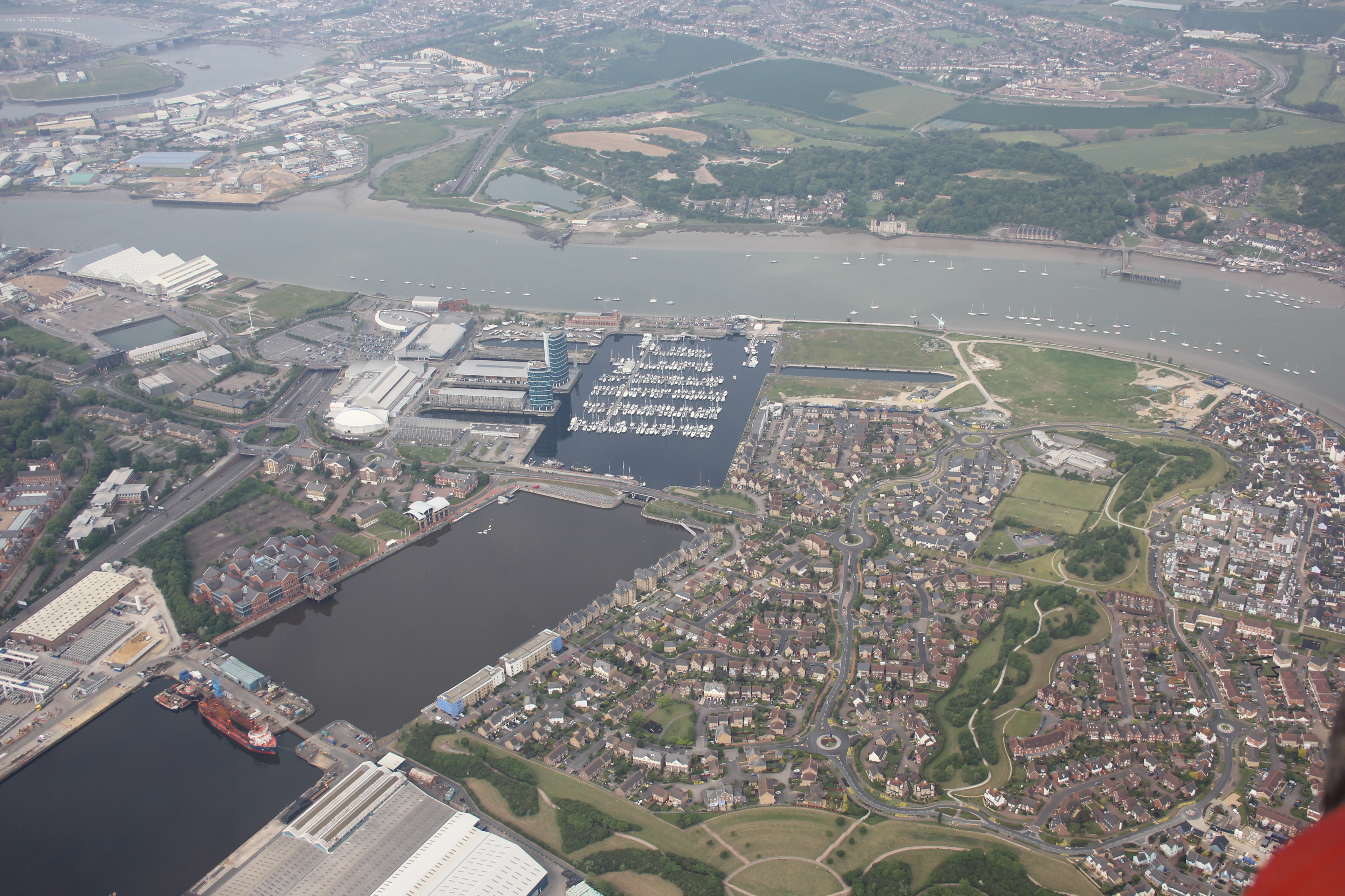 As we headed over to Chatham Alex’s microlight suddenly started to descend. I watched it until it sunk below the side of my craft and was lost from view. We carried on at the same altitude. My pilot pointed out Chatham Historic Dockyard below; I could just make out the ships and submarine displayed there. Then my pilot (who was the club’s Chief Instructor) tutted. He had spotted Alex’s microlight flying over the dockyard far below. “He shouldn’t be flying that low over a built up area,” he said. Oh dear – it sounded as if Alex’s pilot was going to get an ear-full for his transgression!
I had to look for a full few seconds before I spotted him. Can you see him? If you look hard enough he’s there – I assure you!
 Alex’s microlight didn’t spend long that low. As we both turned north his craft started gaining height whilst my pilot dipped his nose and took us down. Soon we were flying together again.

Points on this walk (copy and paste the co-ordinates into Google Earth):
- Stoke Airfield: N 51° 26.679 E 000° 37.888
- U-Boat Wreck: N 51° 25.840 E 000° 37.915
- Kingsnorth Power Station: N 51° 25.098 E 000° 36.196
- St Mary’s Island: N 51° 24.400 E 000° 32.200
- Medway Tunnel: N 51° 24.020 E 000° 32.020
- Chatham Historic Dockyard: N 51° 23.720 E 000° 31.600
Walk Statistics:
- Date of Flight: 17 May 2014

I love that you were able to get the pictures of the power station – that’s really funny!
How noisy was the plane/glider/flying machine? Could your pilot just talk to you ‘regular’,
or did you guys have headsets to communicate?
The views are fantastic – I would love to try that someday!